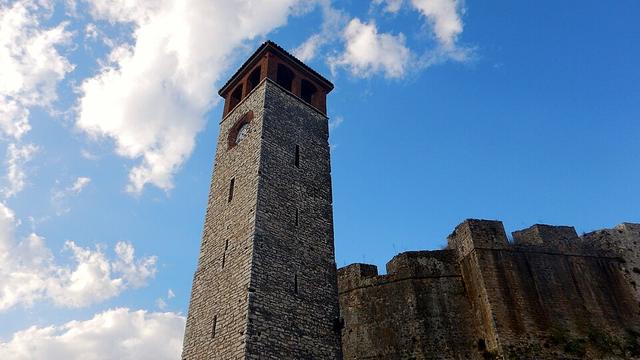
The castle's walls and history
280 m long, a double wall and 800 years of history, from the Despotate to union with Greece.
- Size
- About 280 m long, up to 175 m wide
- Wall
- Inner about 10 m, outer 4–5 m
- Thickness
- About 2.5 m
- Ottoman conquest
- 1449
The Castle of Arta stands at the northeastern edge of the town, at a bend of the Arachthos, which now flows about 200 m to the east. It was built on the site of the lower town of ancient Ambracia, which had been abandoned after the foundation of Nikopolis in 31 BC.
Walls and towers
It has an irregular shape, about 280 m long on its northeast–southwest axis and up to 175 m wide. The eastern side is a single wall that incorporates part of Ambracia's ancient city wall. On the other sides there is an inner wall about 10 m high, with towers, and an outer wall 4–5 m high. The walls are about 2.5 m thick. The Ottomans and Venetians modified towers and parapets for artillery.
History
Arta is first documented in 1082, when the Normans besieged it. The castle was most likely built under Michael II (1230–1266/68), judging by a monogram found in a tower near the main gate. It changed hands many times: Byzantines (1338/39), Serbs, the Albanian Peter Losha and Carlo I Tocco (1416). The Ottomans took it in 1449 and the Venetians held it in the Morean War (1684–1699). In 1717 it became a mainland dependency of the Ionian Islands, in 1797 it passed to the French and in 1799 to Ali Pasha. The Ottomans held it until 1881.
Inside the castle
Remains of a Byzantine church and a building may have belonged to the palace of the Despots of Epirus. Almost all interior archaeological remains were destroyed by a Xenia hotel built in the 1960s.